Summer field experiences support undergraduate learning for American Indian students at the School of Mines
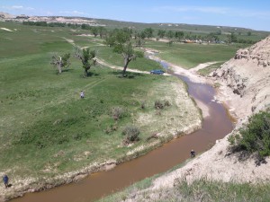
A 40-mile-long fault zone east of the Black Hills has become an open-air laboratory this summer for a team of students and faculty from the South Dakota School of Mines and Oglala Lakota College.
The immediate goal is to map the geologic features of the rugged and semi arid region. But the larger purpose, according to team members, is to test new approaches to undergraduate instruction and support development of reservation communities in South Dakota.
This summer field experience is a collaboration between the School of Mines and Technology, a state-supported institution, and Oglala Lakota College, a tribally controlled college located on the Pine Ridge Reservation. Both institutions are part of the NSF-funded Pre-Engineering Education Collaboratives.
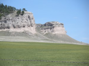
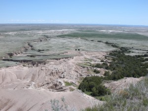
Project Director Foster Sawyer, who serves on the faculty at the School of Mines and is the principal investigator for PEEC at his institution, described the White Clay Fault as a large and significant geologic feature running through Shannon County in the southwest corner of the state.
The team of two instructors and two undergraduate students is spending much of the summer mapping this feature. Regular trips to the fault provide a hands-on opportunity to identify and interpret rocks, fossils, and minerals that can provide rich insight into the formation of the region, said Sawyer. This basic research adds to the still incomplete documentation of the region’s geology.
“The things we see are going to give us information about tectonic events in the region, like the timing of the uplift of the Black Hills,” he said. “It has the potential to contribute some real information on some pretty meaningful questions.”
However, the summer-long field experience is also intended to test new approaches to undergraduate instruction in geology. Most programs do not provide fieldwork until the junior year, on the assumption that coursework must precede practical experience. However, this program is testing the increasingly popular idea that basic skills can be learned in the field and that inexperienced students can contribute to real research projects.
It’s part of what Sawyer calls the “vertical integration” of the curriculum. Field-based instruction combines observation and analysis, producing a richer and more relevant education.
This is an opportunity welcomed by Tyler Rust, a rising sophomore at the School of Mines, who is a member of the Oglala Sioux Tribe. Getting a jump start on fieldwork, he said, allows him to get a better understanding of his chosen profession. “You get an idea of what this job is like instead of going to school for four years and then seeing what it’s all about.”
Student Kristina Proietti agreed. A senior at the School of Mines, she followed a more traditional curriculum, but as a participant in this summer’s field experience, she sees how Tyler is getting a head start on his career. “Learning in the field is hands-on work,” she said. “You can sit in the lab and work with paper but you really don’t learn it until you go in the field and get data yourself.”
This is especially important for Indian students, according to Jim Sanovia, a faculty member at Oglala Lakota College, who also serves as an instructor and mentor in the summer program. American Indian students are often offered positions of leadership as soon as they graduate, he explained, reflecting the shortage of tribal members trained in STEM fields and the need for their expertise in reservation communities.
New graduates are “thrust into a management position, or become the boss, or are the only one with field experience” before the ink on their diplomas are dry, he said. In some cases, they are hired into these positions even before they graduate.
“It happened to me,” said Sanovia, who is a member of the Rosebud Sioux Tribe. A recent graduate of Oglala Lakota College, he was hired by the tribal college as a faculty member and GIS expert before he completed his graduate coursework at the School of Mines. He felt qualified, but he knows that earlier and more extensive fieldwork offered by this program will give future graduates an even greater advantage.
This early exposure to fieldwork poses challenges, as well, Sawyer acknowledged. Lacking some introductory coursework means that students need more instruction and support in the field. “Take students out in the field and hand them a map and say, ‘We’re going to do geologic mapping:’ That’s zero to sixty in about one second.”
But for committed students the benefits are real. Advocates say they learn more, are better prepared for work, and gain the skills and confidence needed to help their communities as soon as they graduate.