Oglala Lakota College is using the power of big data to develop flood maps that will help protect the reservation in a changing climate
By Melanie Lenart
A warming climate comes with more extreme floods, as scientists have long warned and are now documenting. Yet, unlike the rest of the country, tribal reservations generally do not have data-driven flood maps to help leaders make decisions.
This could change in years to come, thanks to a push by Oglala Lakota College, located on the Pine Ridge Reservation in South Dakota. The college and its many partners encourage tribal colleges and universities to use “open source” datasets for practical purposes, including creating flood maps for tribal nations.
James J. Sanovia, a GIS instructor at the college until this summer, credited former colleague and ongoing collaborator Charles Jason Tinant with the idea of producing flood maps mimicking the ones the Federal Emergency Management Agency provides for the rest of the United States.
“He proposed the idea of ‘Let’s create an uncertified flood map, following FEMA protocols as much as we can, so at least the tribes have something’,” Sanovia said. “Because right now they have nothing.”
TCUs explore using big data
Sanovia began leading webinars on Earth Data Science in Indian Country in February to discuss needs, interests and concerns among tribal college faculty. The plan is to ensure they and tribal college students get the proper training and infrastructure to deal with what some call big data, which are open-source datasets too large to store in a laptop but freely available to anyone via the internet.
“If you’re going to do a 100-year analysis on climate, you can’t download all that data. It’s too much,” he said. “My awesome laptop became awesome no more when I began to work with big data.”
Climate data, for instance, includes daily and often hourly tallies of temperature, rainfall and other measurements from every weather station in the country. That’s too much data to be stored outside of the expensive supercomputers controlled by private companies and government agencies.
Billions of data points can go into the U.S. Geological Survey three-dimensional mapping of a reservation, with flood maps highlighted as a potential product. USGS is finishing off a massive effort begun five or six years ago to use “Lidar” technology to map every corner of the country. This Light Detection And Ranging technology bounces lasers off the landscape, usually from drones or small planes, to create so-called 3DEP maps with a precise resolution of about two feet horizontally and four inches vertically.
Tribal nations did not have the option to decline the probing scan.
“The USGS is Lidar-ing the whole country,” said Sanovia, an enrolled member of the Rosebud Sioux Tribe. Yet, “at least half the tribes I talked to were not aware of it. They were just told after the fact. I’ve only met a couple who got a heads-up notice. But they (USGS officials) were going to do it anyway.”
Sanovia recounted how an Indigenous man from Alaskan came to him with questions about the USGS Lidar effort. In this case, USGS employees let his tribe know about their plans, but they never showed anyone from the tribe how to access the resulting data.
“So, I downloaded a Lidar dataset for them, all in five minutes. And I go, ‘that’s how easy it will be to access this data. And what are you going to do about it?’ ” Protecting sensitive data is a recurring topic during the biweekly webinars, he said. “A lot of what’s missing is data sovereignty language and data governance. And so we’re just taking it slow and figuring it out as we go.”
Getting a handle on big data
Sanovia started at Oglala Lakota College as a student in 2001, where he did internships involving data science. After completing a master’s degree at South Dakota School of Mines, he returned to OLC about 12 years ago as a faculty member teaching GIS courses.
At first, Sanovia was reluctant to get into big data. It wasn’t until a 2019 Earth Science summit that he warmed to the idea. During a short course he took there on the coding language Python, he watched the instructor perform an analysis.
“He did something with USGS data that took him about 15 minutes to get all this data into a map and working.” Sanovia calculated that he would have needed three or four hours of preparation work to do something similar using ArcGIS software. “I was sold. I thought, ‘I need this efficiency in my life and so does this department, and everyone’.”
Sanovia is taking on a new role that gives him the opportunity to “go big” by interacting with tribal nations and tribal colleges around the United States. He’s in the process of moving to Boulder to work at the University of Colorado’s Environmental Data Science Innovation & Inclusion Lab, in the role of tribal resilience data scientist.
The National Science Foundation funds the Boulder lab. NSF also just awarded Oglala Lakota College a $2.5 million data science grant that starts in October. Other supporters of the multi-pronged effort to expand data science among tribal colleges include Esri, the company that produces the proprietary ArcGIS software, and the American Indian Higher Education Consortium. AIHEC helped launch and publicize the biweekly webinars, Sanovia said, and is interested in spreading the idea of creating flood maps via tribal colleges and universities. Tinant also plans to work with AIHEC to share the course modules the college plans to develop as part of the new NSF project.
Incorporating big data into science courses
Oglala Lakota College plans to expose its students to data science projects in 20 of its STEM courses, from Animal Behavior to Fluvial Morphology to Wetlands. The five-year NSF grant will help six faculty members develop relevant modules for teaching the college’s roughly 1,500 students, including the typically 200 to 250 students seeking STEM degrees.
“If you’re getting a taste of it every semester you’re in school, you start to link those things together,” Tinant said.
Faculty also plan to develop some 1-credit course modules to make it easier for resource agency staff and other full-time workers to learn the ArcGIS software the company provides tribal nations at a discounted rate. Eventually, they could earn an upcoming 12-credit GIS certificate. “It’s hard to do science these days without starting to use data science tools,” Tinant said. “In my mind, it’s about empowerment. Because when you’re able to look at the data, when you have the data skills to be able to digest that information, you’re in a different place when it comes to negotiating some of the bigger issues.”
A water resources engineer, Tinant has been a faculty member of Oglala Lakota College for 17 years. During the pandemic, he finished his doctorate with the South Dakota School of Mines with a project using big data to consider drought history on the Pine Ridge Reservation.
He and other Oglala Lakota College faculty now will use Lidar data to analyze the White Clay fault and the river of the same name. Tinant said faculty members will be working with their students to use high-resolution Lidar data from drones to consider how the fault might be affecting groundwater supplies. Faults can make it easier for groundwater to reach the surface, thus keeping rivers flowing during dry spells. However, they can also provide a shortcut for river water to flow down into the groundwater aquifer—bypassing the usual purification process that occurs when water filters through soil.
Their results potentially have real-world applications. Studying the fault as it relates to other landscape features could help them determine whether pollution from the uranium mine upstream might make its way into Pine Ridge’s groundwater. Currently, many residents tap into it via wells for drinking water,
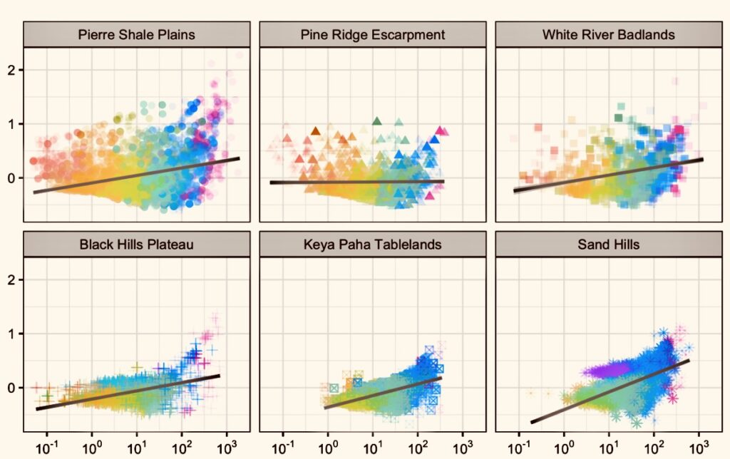
Plans also call for using big data to assess White Clay Creek, which passes through the reservation’s biggest town, Pine Ridge Village. Future work could involve creating flood maps to consider where and how frequently Pine Ridge Village residents might expect to see floodwaters rising.
Tinant said the informal flood maps, for Pine Ridge and other tribal nations too, could be certified if the efforts include working with the tribes’ natural resource agencies and a registered engineer.
Big data v. traditional knowledge
Sanovia’s ancestors, the Sičáŋǧu Lakóta Oyáte, named rivers like Rapid Creek to reflect stream behavior. The affiliated Lakota Dakota Nakota tribal members migrated across a wide range well beyond the confines of their modern-day reservations, and passed down knowledge about the rivers in their homeland.
“It’s called Mniluzuhan, or Rapid Creek, for a purpose. It’s a small stream that can get violent—and it flooded the whole city in 1972,” Sanovia said. The Cheyenne River, on the other hand, is wide and shallow. “And so they called that The Good River,” or Wakpa Waste in Lakota.
His ancestors set up temporary housing and migrated throughout the year, avoiding camping near potentially dangerous rivers during the rainy season. But the government push to build permanent housing, often in places that naturally would support lagoons, now makes people more vulnerable to floods, Sanovia said.
In the face of climate change, with its bigger floods and more extreme weather in general, analyzing big data can help increase resilience. That’s not to say tribal nations are thrilled that anyone with the proper computer and some skills can develop detailed maps using freely available data.
“What if some rogue professor—and there are plenty of rogue professors out there—said ‘Oh, I’m going to map all of Pine Ridge’s culture for them. I’m going to go find their Pow Wow grounds and I’ll publish it and they’ll be thankful, right? They’ll be happy I did that,’ “ Sanovia said. “No, they won’t.”
Sanovia remembered reading about a study where researchers used Lidar in northern Michigan to detect the cache pits Indigenous peoples used to store food, often lining them with ice from nearby lakes for extended storage. The 2016 publication of the research led by Meghan C.L. Howey, an anthropologist with the University of New Hampshire, contains no indication that any of the local tribal nations were consulted about this effort, which he found troubling. https://greatlakesecho.org/2016/11/10/remote-sensing-technology-improves-small-scale-archaeology/
In the long run, he’d like to see Indigenous peoples work together to demand pop-up warnings when users access datasets from sovereign tribal nations. The box could include contact information for officials to check in with before publishing any products from analyses focused on tribal lands.
This would fit in with the proposed international principles Tinant supports, known as the CARE Principles for Indigenous Data Governance. Among other goals, the principles suggest that “the use of Indigenous data should result in tangible benefits for Indigenous collectives through inclusive development and innovation, improved governance and citizen engagement, and result in equitable outcomes.” [LINK: https://www.nature.com/articles/s41597-021-00892-0 ]
In the short term, Sanovia plans to ensure tribal colleges and nations at least know what’s out there by providing those interested with “data libraries”—basically spreadsheets that list all the open-source data available on the internet for a specific area or tribal nation. The libraries come with links for accessing the information.
“I teach my students you need to take charge of this, you need to start working with the data—of course working with the tribe to make sure you have that go-ahead,” he said, noting most tribal nations have a Tribal Historic Preservation Office or something equivalent to give the go-ahead on what TCUs can do. “But you need to take control of that. Let’s us start making our own datasets and do what we want to do to it. Then they’ll know to come to us.”
Melanie Lenart is a contributing editor to Native Science Report. She wrote about big data in the context of Indigenous seed protection in April.
Story published July 31, 2023
• • •
Enjoyed this story? Enter your email to receive notifications.